
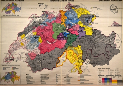
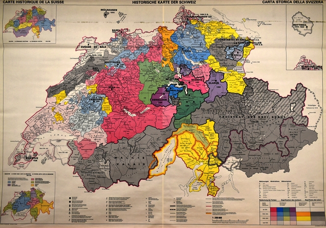
Grosjean, Georges (1971). Carte historique de la Suisse [Map]. Bern: Kümmerly & Frey
![[img]](https://boris.unibe.ch/186559/1/Grosjean_1971_Historische_Karte_der_Schweiz.jpg)
|
Image (Schulwandkarte 1 : 200 000)
Grosjean_1971_Historische_Karte_der_Schweiz.jpg - Published Version Available under License BORIS Standard License. Download (10MB) | Preview |
|
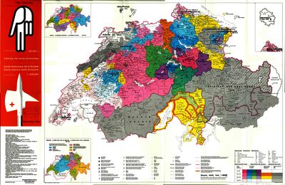
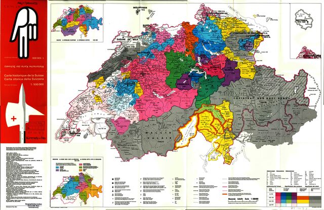
![[img]](https://boris.unibe.ch/186559/6/Grosjean_1972_Historische_Karte_der_Schweiz_1zu500000.jpg)
|
Image (Schülerkarte 1 : 500 000)
Grosjean_1972_Historische_Karte_der_Schweiz_1zu500000.jpg - Published Version Available under License BORIS Standard License. Download (8MB) | Preview |
|
|
Text (Beiheft zur Schülerkarte)
Grosjean_1972_Beiheft.pdf - Published Version Available under License BORIS Standard License. Download (7MB) | Preview |
|
|
Text (Commentaire)
Grosjean_1972_Commentaire.pdf - Published Version Available under License BORIS Standard License. Download (8MB) | Preview |
Schulwandkarte 1 : 200 000 (1971), Schüler Handkarte 1 : 500 000 (1972) inkl. Begleitheft (deutsch und französisch)
Item Type: |
Audiovisual Material & Event (Map) |
|---|---|
Division/Institute: |
08 Faculty of Science > Institute of Geography |
Subjects: |
900 History > 910 Geography & travel |
Publisher: |
Kümmerly & Frey |
Language: |
German |
Submitter: |
Thomas Jürg Reist |
Date Deposited: |
26 Sep 2023 07:55 |
Last Modified: |
27 Sep 2023 15:33 |
Related URLs: |
|
Additional Information: |
Georges Grosjean (1921–2002) war von 1963 bis 1986 Professor für Kultur- und Wirtschaftsgeographie am Geographischen Institut der Universität Bern. |
BORIS DOI: |
10.48350/186559 |
URI: |
https://boris.unibe.ch/id/eprint/186559 |
Actions (login required)
 |
Edit item |